Longport in the 1790s

A Description of the Country From Thirty to Forty Miles Round Manchester, a book published in 1795, was compiled by Dr John Aikin. The book tells us about Newcastle-under-Lyme and North Staffordshire’s pottery towns and villages in the 1790s.

This edited extract from the book describes Longport in the 1790s.

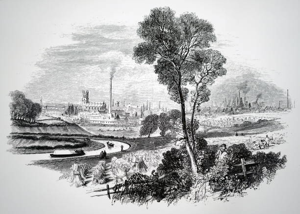
Longport is situated in a valley between Burslem and Newcastle. There are some good buildings in it and several large pottery factories. Because it is in a valley, there are times when the smoke from bottle ovens and kilns hangs over Longport, making the air disagreeable, if not unwholesome.

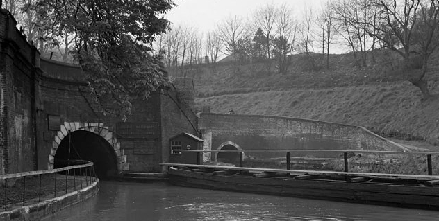
The Trent & Mersey Canal passes through Longport, where there is a public canal wharf. Before the canal was constructed, Longport was called Longbridge Hays because there was a kind of bridge that ran parallel for a hundred yards with the Fowlea Brook. The bridge was dismantled when the canal was cut.

The number of buildings increased rapidly when the canal was completed, and the village’s name was changed from Longbridge Hays to Longport.

Bygone Kidsgrove

The Trent & Mersey Canal and the Harecastle Tunnels will help to make North Staffordshire’s Industrial Landscape a World Heritage Site.

The Fowlea Brook Valley Looking Towards Burslem in the 1860s

This engraving of the Fowlea Brook Valley looking towards Burslem was made in the 1860s. Note the sheaves of corn and the Trent & Mersey Canal in the foreground. In the background, you can see Burslem and St. Paul’s Church, Dalehall, where John Ward, who published The Borough of Stoke-upon-Trent in 1843, was churchwarden.

18th Century potters left North Staffordshire to work in Liverpool

My story begins with a journey from Burslem in Staffordshire to Toxteth in Liverpool in November 1796.

To read the post, press the title A Herculaneum Potter (above).

Etruria Industrial Museum

This video showcases Etruria Industrial Museum. The museum is housed in a 19th century steam powered potter’s bone and flint mill. Built in 1857, the mill is a Grade II* listed building.

The museum is at Etruria Junction, where the Caldon Canal joins the Trent & Mersey Canal.

There is a statue of James Brindley (1716–1772) at the junction, which was the site of Etruria Wharf. A tramway ran from the wharf to Hanley/City Centre. The site of Stoke-on-Trent’s first public hospital is near the museum. Built in 1803, the hospital was called the Dispensary and House of Recovery.

1970s Photographs of Etruria

The area was named by Josiah Wedgewood when he built his new pottery works here in 1769 (it was named after the region of Etruria in Italy in an early example of somewhat fanciful marketing). By the early 1970s, the pottery works had been moved, and the old canal was caught in the doldrums between commercial and leisure traffic.

Note: We viewed Alan’s photographs with great interest and were most impressed by their quality.

During the late 1960s, David photographed the Trent & Mersey and the Caldon Canal for a group of canal enthusiasts opposing British Waterways’ plans to close the canal and turn it into a feeder channel for the Trent & Mersey Canal.

North Staffordshire’s Industrial Landscape Merits World Heritage Site Status

The Harecastle Tunnels on the Trent & Mersey Canal at Kidsgrove

There are no historical reasons to prevent North Staffordshire’s Industrial Landscape from becoming a World Heritage Site.

In the 18th century, North Staffordshire helped to make England “the workshop of the world.” Local entrepreneurs, like Wedgwood and Adams, transformed a group of small towns into an industrial area of international importance.

James Brindley’s Trent & Mersey Canal “kick-started” the Industrial Revolution, which made Britain “the Workshop of the World. The canal and railway tunnels between Kidsgrove and Chatterley are significant feats of civil engineering. They merit World Heritage Site status in their own right.

The Primitive Methodist Church was founded in North Staffordshire by Hugh Bourne and William Clowes. It gave the Potteries its unique culture and a way of life that Arnold Bennett vividly portrayed in his novels.

Burslem’s “old town hall” is one of the finest examples of Victorian civic architecture. The Wedgwood Institute’s terracotta facade is an inspiring tribute to the men, women and children who worked in local industries.

The former colliery at Chatterley Whitfield should have been made a World Heritage Site many years ago.

Making North Staffordshire’s Industrial Landscape a World Heritage Site would encourage economic regeneration and create new employment opportunities.

Tunstall Was a Prosperous Town

In the 1830s, Tunstall was a prosperous industrial and market town.

There were 17 firms manufacturing pottery. Twelve made earthenware. Three produced earthenware and china. Two manufactured china figures and Egyptian blackware.

The Trent & Mersey Canal ran through the Chatterley Valley. In the valley, there were two brick and tile works. There was a factory making chemicals at Clayhills and a coal wharf on the banks of the canal. Coal and ironstone were mined at Newfield and Clanway.

The east side of Liverpool Road (High Street) from the Highgate Inn to the Old Wheatsheaf Inn had been developed. There were shops on Liverpool Road and in Market Place (Tower Square) where a market was held on Saturdays.

A typical 19th-century market where green grocers displayed fruit and vegetables in wicker baskets.

The market opened early in the morning and closed late at night. It was a bustling market with stalls selling a wide range of goods, including household items, furniture, shoes, and clothing. Green grocers sold fruit and vegetables. Farmers’ wives had stalls in the Market Hall, where they sold eggs, butter and cheese. Between the Market Hall and Liverpool Road were stalls selling meat, fish and poultry.

Saturday was the busiest day of the week for shopkeepers and innkeepers. The market attracted customers from Butt Lane, Kidsgrove, Mow Cop, Harriseahead, Packmoor, Biddulph, Chell and Goldenhill.

Copyright David Martin 2023

NSH2023/Revised2025

Hanley and Shelton in the 18th century

During the 18th century, Hanley and Shelton became the most important towns in the Potteries.

Between 1762 and 1801, their populations increased from 2,000 to 7,940. Hanley’s first church, St. John’s, was erected in 1738 and enlarged in the 1760s. Stage coaches called at the Swan Inn. Horse-drawn wagons carried pottery to the Weaver Navigation at Winsford and returned carrying ball clay and household goods.

A covered market, designed by architect James Trubshaw, was built on Town Road in 1776.

The Trent and Mersey and the Caldon Canals stimulated economic expansion. Entrepreneurs opened factories, collieries and ironworks. Families from the surrounding countryside flocked to Hanley and Shelton looking for work. New houses were built to accommodate them.

In 1791, a trust was formed to manage the market and build a town hall. The trustees leased land in Market Square, where they erected a town hall. Markets were held on Wednesdays and Saturdays. A fortnightly cattle market was established at the beginning of the 19th century. In 1813, Parliament gave the trustees the power to regenerate Market Square. They demolished the town hall, replacing it with a poultry market. A lockup was also built where those arrested were held before being brought to court.

Revised 04.06.2025